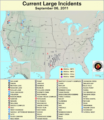
Map of the concentration of wildfires in East Texas.
National map with fires in Texas and other areas cluster fo fires now approaching southeastern Oklahoma, southwestern Arkansas (Texarkana vicinity) and Louisiana (Shreveport vicinity):
"Active Fire Mapping Program" with "Current Large Incidents," as of September 6, 2011:
http://activefiremaps.fs.fed.us/
Guide to terms used, e.g., Incident Management Team:
http://en.wikipedia.org/wiki/Incident_management_team

Wednesday, September 7, 2011
Subscribe to:
Post Comments (Atom)


No comments:
Post a Comment